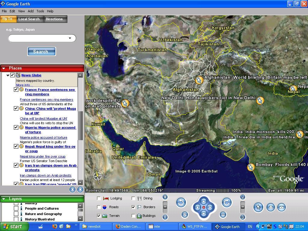
 Google has developed a mapping software that seems to have all kinds of uses. One that might be applicable to schools is a news map called NewsGlobe that plots stories by location. As journalism.co.uk describes it: "The tool scans headlines for keywords that identify the location of the story, and then presents them by headline with the location pinpointed. A summary of the story appears when the user hovers over the text and they can click through the the full story on the original news site."
Students can subscribe to different news publications that put out RSS feeds (New York Times, BBC, Washington Post, etc.) and follow the way events are covered by them. This would lead to an interesting study for journalism classes, but also might have uses for any class that is studying a certain region or even local current events. Google Earth also has a bulletin board that encourages discussion from educators and others about how the software might be used in the classroom.
No comments:
Post a Comment